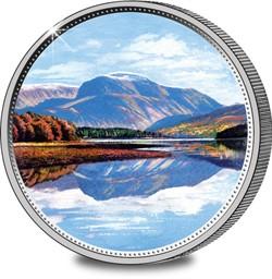
-no-button.jpg)
 |
Location: Lochaber, Scottish Highlands
Date completed: Formed c.350 million
years ago
Designers/builders: Natural feature
Function: Tourist, walking and climbing
centre
|
These days the Scottish mountain Ben Nevis is a popular tourist
attraction, with an estimated 100,000 people a year making the
ascent. Yet the first recorded ascent was only in 1771 by a
collector of botanical specimens. By 1819 a visitor was complaining
of the litter at the summit. At 4,409 ft (1,344 m) Ben Nevis
may be small by Everest standards, but it's the highest mountain in
Britain and it would be a mistake to take it lightly. Fog is common
on the mountain and the mean monthly temperature is just -0. 5o C
(31. 1oF) - compared to 11oC (52oF) in central London - and
an average year sees 261 gales at the summit and 171 in (4,350 mm)
of rain (cf. 23 in (588 mm) per year in London). Snow can
often be found in gullies all the year round. The result is that in
1999 there were 41 mountain rescues and 4 fatalities on Ben Nevis.
Of course, it should be remembered that these figures also include
the mountaineers and rock climbers who tackle the challenging
cliffs of Ben Nevis. Most casual visitors use the Pony Track to the
summit, although even this has to be treated with respect,
especially in bad weather. Once at the summit, the visitor will
find a broad plateau of about 100 acres (40 hectare) with an
ordnance survey trig point marking the highest point. The views are
spectacular - there's no higher ground westward, including the rest
of Britain, Belgium and Holland until you get to mountains of
Norway. On a rare clear day you can see to Northern Ireland. You
can also see the remains of a meteorological observatory that was
built in 1883 and manned until 1904, as well as a memorial to the
dead of World War II.
Ben Nevis was formed some 350 million years ago in the
Carboniferous era when a huge volcano collapsed in on itself,
creating an explosion comparable to Krakatau. Ben Nevis is what
remains of the inner dome, shaped over the years by weather and
glacial action. The mountain is located at the western end of the
Grampian mountain range, close to Fort William.